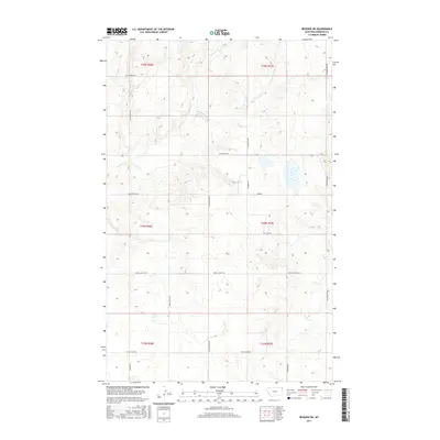
2017 Map of Reserve NE
USGS Topo · Published 2017About this map
Antelope Cr and its S Fork Antelope Cr define the drainage patterns of this Sheridan County landscape, where the township grid meets a network of local corridors named for the families and valleys of the region. The territory is characterized by a high-plains geography partitioned into legal townships such as t34n r57e and t35n r56e. A concentrated system of secondary routes, including the Coalridge Hwy and Eden Valley Rd, suggests a settled agricultural continuity where transportation follows the natural breaks of the land. Key transit points like Monroe and named routes such as Lew Wallace Rd provide a clear view of how land ownership and access were structured in this part of northeastern Montana during the early 21st century.
Find a feature on this map
23 named features on this map. Tap any name to fly to it.
Don’t see what you’re looking for? This feature index may not catch every label — zoom into the map to look around manually.
Map Details
Editions of this 2017 Reserve NE Map
This is the sole edition of this map. No revisions or reprints were ever made.
Other maps of this area

1946 · Dagmar
USGS Topo · 1:24,000

1948 · Dagmar
USGS Topo · 1:24,000

1948 · Reserve SE
USGS Topo · 1:24,000

1948 · Reserve
USGS Topo · 1:24,000

1948 · Antelope
USGS Topo · 1:24,000

1949 · Reserve SE
USGS Topo · 1:24,000

1949 · Reserve
USGS Topo · 1:24,000

1949 · Antelope
USGS Topo · 1:24,000

1954 · Wolf Point
USGS Topo · 1:250,000

1958 · Wolf Point
USGS Topo · 1:250,000