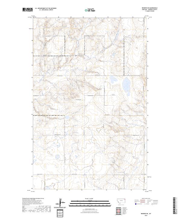
2024 Map of Reserve NE
USGS Topo · Published 2024About this map
Antelope Creek and its tributary, the South Fork Antelope Creek, drain this corner of Sheridan County, Montana. The landscape is structured by a grid of rural roads and section lines, reflecting the modern agricultural and ranching layout of the region. Significant thoroughfares like the Coalridge Hwy and Twin Bridges Rd intersect the terrain, providing access to the open range and scattered homesteads. These roads, including Lew Wallace Rd and Nathanael Rd, follow the natural contours of the northern plains, tracing the subtle elevation changes of the northeastern Montana countryside. The map serves as a primary source for understanding the 21st-century configuration of local land divisions and the hydrologic network that supports the surrounding prairie environment.
Find a feature on this map
21 named features on this map. Tap any name to fly to it.
Don’t see what you’re looking for? This feature index may not catch every label — zoom into the map to look around manually.
Map Details
Editions of this 2024 Reserve NE Map
This is the sole edition of this map. No revisions or reprints were ever made.
Other maps of this area

1946 · Dagmar
USGS Topo · 1:24,000

1948 · Dagmar
USGS Topo · 1:24,000

1948 · Reserve SE
USGS Topo · 1:24,000

1948 · Reserve
USGS Topo · 1:24,000

1948 · Antelope
USGS Topo · 1:24,000

1949 · Reserve SE
USGS Topo · 1:24,000

1949 · Reserve
USGS Topo · 1:24,000

1949 · Antelope
USGS Topo · 1:24,000

1954 · Wolf Point
USGS Topo · 1:250,000

1958 · Wolf Point
USGS Topo · 1:250,000