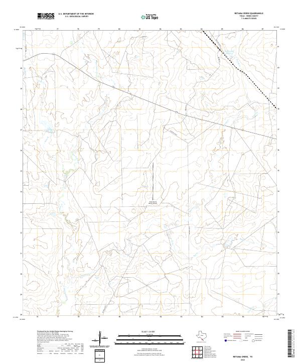
2022 Map of Retama Creek
USGS Topo · Published 2022About this map
Santa Maria Ranch Airport anchors this section of Webb County, a landscape defined by an intricate network of intermittent watercourses that drain the South Texas brush country. The map illustrates the convergence of several ephemeral streams, including Lobo Cr and San Juanito Cr to the west, while Retama Cr winds through the central and eastern sections. These drainage patterns dictate the sparse settlement and agricultural footprints typical of the Rio Grande plain.
Find a feature on this map
12 named features on this map. Tap any name to fly to it.
Don’t see what you’re looking for? This feature index may not catch every label — zoom into the map to look around manually.
Map Details
Editions of this 2022 Retama Creek Map
This is the sole edition of this map. No revisions or reprints were ever made.
Other maps of this area

1933 · Becerra Creek
USGS Topo · 1:62,500

1937 · Aguilete Creek
USGS Topo · 1:62,500

1940 · Aguilares
USGS Topo · 1:62,500

1956 · Laredo East
USGS Topo · 1:62,500

1956 · Laredo
USGS Topo · 1:250,000

1965 · Tios Creek
USGS Topo · 1:24,000

1980 · Blancas Creek North
USGS Topo · 1:24,000
1980 · Agua Azul Creek East
USGS Topo · 1:24,000
1980 · Mirando City
USGS Topo · 1:24,000
1980 · Burrito Tank
USGS Topo · 1:24,000