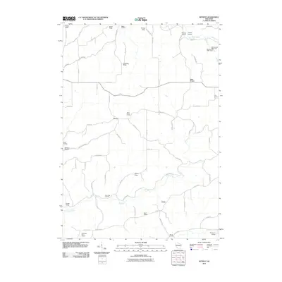
2010 Map of Retreat
USGS Topo · Published 2010About this map
Retreat and the neighboring community of West Prairie anchor this corner of Crawford County, where the landscape is defined by the complex driftless-area topography of long ridges and deep hollows. The settlement pattern follows these natural features, with roads like County Hwy-N and Bolstad Rd navigating between Bishop Ridge and Anderson Ridge. Genealogists will find a significant record of local families at Walnut Mound Cemetery, Fargo Cemetery, and Rush Creek Cemetery, each positioned near the small centers of rural life. The drainage of Rush Creek and its various tributaries, including Bull Run, carve through the terrain toward the south, while the Bad Axe 24 D 2592.1 Dam represents a more modern layer of water management. The presence of Callahans Farm Airport near the southern edge at Reed highlights the ongoing utility of these agricultural uplands.
Find a feature on this map
67 named features on this map. Tap any name to fly to it.
Don’t see what you’re looking for? This feature index may not catch every label — zoom into the map to look around manually.
Map Details
Editions of this 2010 Retreat Map
This is the sole edition of this map. No revisions or reprints were ever made.
Other maps of this area

1903 · Waukon
USGS Topo · 1:125,000

1923 · Viroqua
USGS Topo · 1:62,500

1924 · Gays Mills
USGS Topo · 1:62,500

1926 · Gays Mills
USGS Topo · 1:62,500

1926 · Stoddard
USGS Topo · 1:62,500

1926 · Viroqua
USGS Topo · 1:62,500

1929 · Ferryville
USGS Topo · 1:62,500

1932 · Ferryville
USGS Topo · 1:62,500

1958 · La Crosse
USGS Topo · 1:250,000

1961 · La Crosse
USGS Topo · 1:250,000