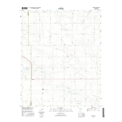
2016 Map of Retrop
USGS Topo · Published 2016About this map
Old Retrop and its neighbor Retrop anchor the southern portion of this landscape along the county line separating Beckham Co and Washita Co. The region is defined by a high concentration of water management features, specifically a series of flood control structures including Upper Elk Creek Site 13 Reservoir and Upper Elk Creek Site 40 Reservoir, which regulate the flow of Elk Cr and Trail Cr.
Find a feature on this map
44 named features on this map. Tap any name to fly to it.
Don’t see what you’re looking for? This feature index may not catch every label — zoom into the map to look around manually.
Map Details
Editions of this 2016 Retrop Map
This is the sole edition of this map. No revisions or reprints were ever made.
Other maps of this area

1955 · Clinton
USGS Topo · 1:250,000

1957 · Clinton
USGS Topo · 1:250,000

1957 · Dill City
USGS Topo · 1:62,500

1961 · Hobart
USGS Topo · 1:62,500

1961 · Retrop
USGS Topo · 1:62,500

1961 · Elk City
USGS Topo · 1:62,500

1983 · Dill City
USGS Topo · 1:24,000

1984 · Sentinel
USGS Topo · 1:24,000
1984 · Cambridge
USGS Topo · 1:24,000

1985 · Elk City
USGS Topo · 1:100,000