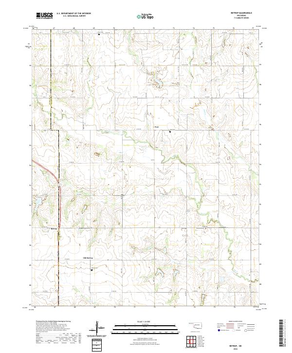
2022 Map of Retrop
USGS Topo · Published 2022About this map
The boundary between Beckham Co and Washita Co bisects this rural landscape, defined by a grid of section-line roads and the winding paths of Elk Cr and Trail Cr. The community of Retrop sits on the western edge, while its historical precursor, Old Retrop, is located to the southeast along with the Retrop Cem. This distinction between the two settlement sites offers a specific look at how local hubs shifted their centers over time. To the north, the small settlement of Port and its associated Port Cem provide further evidence of the area's agricultural heritage. Further genealogical significance is found at Clark Cem on the northern border. The map illustrates a classic Great Plains section-and-township layout, where commerce and community life are dispersed across the ranch and farm lands of western Oklahoma.
Find a feature on this map
42 named features on this map. Tap any name to fly to it.
Don’t see what you’re looking for? This feature index may not catch every label — zoom into the map to look around manually.
Map Details
Editions of this 2022 Retrop Map
This is the sole edition of this map. No revisions or reprints were ever made.
Other maps of this area

1955 · Clinton
USGS Topo · 1:250,000

1957 · Clinton
USGS Topo · 1:250,000

1957 · Dill City
USGS Topo · 1:62,500

1961 · Hobart
USGS Topo · 1:62,500

1961 · Retrop
USGS Topo · 1:62,500

1961 · Elk City
USGS Topo · 1:62,500

1983 · Dill City
USGS Topo · 1:24,000

1984 · Sentinel
USGS Topo · 1:24,000
1984 · Cambridge
USGS Topo · 1:24,000

1985 · Elk City
USGS Topo · 1:100,000