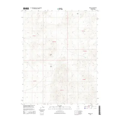
2014 Map of Reveille
USGS Topo · Published 2014About this map
The Reveille Range dominates this landscape in central Nevada, representing a remote section of the Great Basin where high-elevation peaks and arid basins intersect. This 2014 survey documents a rugged and largely unpopulated territory within Nye County, characterized by prominent geological landmarks such as Goblin Knobs and Streuben Knob. The mapping of these peaks alongside rare water sources like Hyde Spring highlights the critical importance of reliable springs in an environment defined by extreme aridity. The intricate contour work illustrates the complex drainages and alluvial fans that spill out from the central range, providing a technical perspective on the topography of the public land survey system divisions like t3n r51.5e and t2.5n r52e before they descend into the surrounding valley floors.
Find a feature on this map
11 named features on this map. Tap any name to fly to it.
Don’t see what you’re looking for? This feature index may not catch every label — zoom into the map to look around manually.
Map Details
Editions of this 2014 Reveille Map
This is the sole edition of this map. No revisions or reprints were ever made.
Other maps of this area

1908 · Kawich
USGS Topo · 1:250,000

1942 · Reveille Peak
USGS Topo · 1:125,000

1952 · Kawich Peak
USGS Topo · 1:62,500

1952 · Reveille Peak
USGS Topo · 1:62,500

1954 · Goldfield
USGS Topo · 1:250,000

1955 · Goldfield
USGS Topo · 1:250,000

1956 · Tonopah
USGS Topo · 1:250,000

1958 · Goldfield
USGS Topo · 1:250,000

1959 · Tonopah
USGS Topo · 1:250,000

1962 · Goldfield
USGS Topo · 1:250,000