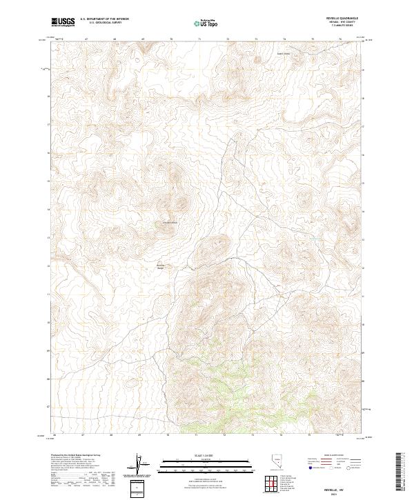
2021 Map of Reveille
USGS Topo · Published 2021About this map
The Reveille Range dominates this portion of Nye County, where the desert floor gives way to a series of distinctive volcanic and geological formations. Among the most prominent of these are the Goblin Knobs in the north and Streuben Knob near the center of the quadrangle. These named high points serve as essential landmarks in an otherwise arid expanse, marking a landscape defined by sharp changes in elevation and the Public Land Survey System grid, which divides the territory into townships like t3n r51.5e and t2n r52e.
Find a feature on this map
11 named features on this map. Tap any name to fly to it.
Don’t see what you’re looking for? This feature index may not catch every label — zoom into the map to look around manually.
Map Details
Editions of this 2021 Reveille Map
This is the sole edition of this map. No revisions or reprints were ever made.
Other maps of this area

1908 · Kawich
USGS Topo · 1:250,000

1942 · Reveille Peak
USGS Topo · 1:125,000

1952 · Kawich Peak
USGS Topo · 1:62,500

1952 · Reveille Peak
USGS Topo · 1:62,500

1954 · Goldfield
USGS Topo · 1:250,000

1955 · Goldfield
USGS Topo · 1:250,000

1956 · Tonopah
USGS Topo · 1:250,000

1958 · Goldfield
USGS Topo · 1:250,000

1959 · Tonopah
USGS Topo · 1:250,000

1962 · Goldfield
USGS Topo · 1:250,000