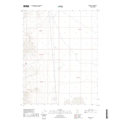
2018 Map of Reveille SE
USGS Topo · Published 2018About this map
Reveille Range dominates the western edge of this desert landscape in Nye County, where steep elevation contours reveal the sharp rise of the mountain front above the valley floor. This 2018 survey documents a largely undeveloped terrain defined by the Bureau of Land Management's rectangular survey system, including portions of t3n r52e, t3n r53e, t2n r52e, and t2n r53e. The most significant human modification to the natural drainage is the Eastside Reservoir located in the northeastern portion of the sheet. Modern infrastructure is represented primarily by State Route 375, which runs north-to-south through the central basin. The map provides a clear look at the relationship between the high range and the alluvial fans that spread toward the east, illustrating the typical basin-and-range topography of central Nevada.
Find a feature on this map
7 named features on this map. Tap any name to fly to it.
Don’t see what you’re looking for? This feature index may not catch every label — zoom into the map to look around manually.
Map Details
Editions of this 2018 Reveille SE Map
This is the sole edition of this map. No revisions or reprints were ever made.
Other maps of this area

1908 · Kawich
USGS Topo · 1:250,000

1942 · Reveille Peak
USGS Topo · 1:125,000

1942 · Penoyer Valley
USGS Topo · 1:125,000

1952 · Reveille Peak
USGS Topo · 1:62,500

1954 · Caliente
USGS Topo · 1:250,000

1954 · Goldfield
USGS Topo · 1:250,000

1955 · Goldfield
USGS Topo · 1:250,000

1956 · Lund
USGS Topo · 1:250,000

1956 · Tonopah
USGS Topo · 1:250,000

1958 · Goldfield
USGS Topo · 1:250,000