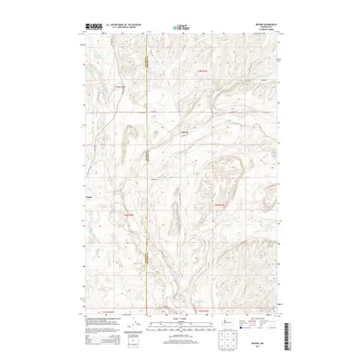
2014 Map of Revere
USGS Topo · Published 2014About this map
The boundary between Adams Co and Whitman Co bisects this Eastern Washington landscape, where the settlements of Revere and Paxton sit along a drainage system defined by intermittent water and basalt-rimmed coulees. The terrain is notably marked by numerous named water features, including Twin Lakes, Back Lake, and Lake Thirty Two, alongside perennial sources like Buffalo Spring and Dragoon Spring. The complex hydrography of Rock Cr and its tributaries, such as McElroy Cr, suggests a region adapted to the seasonal rhythms of the Channeled Scablands. A network of rural roads, including McCall Rd, Revere Rd, and George Knott Rd, connects the scattered farmsteads and agricultural plots that define the area's economic character in the modern era.
Find a feature on this map
31 named features on this map. Tap any name to fly to it.
Don’t see what you’re looking for? This feature index may not catch every label — zoom into the map to look around manually.
Map Details
Editions of this 2014 Revere Map
This is the sole edition of this map. No revisions or reprints were ever made.
Other maps of this area

1950 · La Crosse
USGS Topo · 1:62,500

1950 · Benge
USGS Topo · 1:62,500

1952 · La Crosse
USGS Topo · 1:62,500

1952 · Benge
USGS Topo · 1:62,500

1953 · Walla Walla
USGS Topo · 1:250,000

1953 · Ritzville
USGS Topo · 1:250,000

1955 · Pullman
USGS Topo · 1:250,000

1955 · Spokane
USGS Topo · 1:250,000

1958 · Spokane
USGS Topo · 1:250,000

1958 · Pullman
USGS Topo · 1:250,000