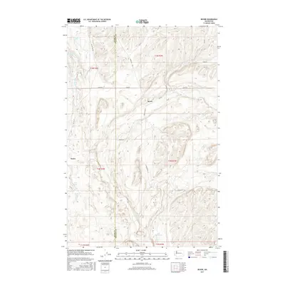
2017 Map of Revere
USGS Topo · Published 2017About this map
Revere and the rail siding of Paxton occupy a landscape shaped by the coulees and scablands of the Columbia Plateau. This 2017 survey by the U.S. Geological Survey details the complex drainage systems of Rock Creek and McElroy Creek, which wind through the basalt-carved terrain of eastern Washington. Scattered across the high desert are numerous water features including Twin Lakes, Wall Lake, and the distinctly named Lake Thirty Two. The map traces a network of rural roads such as McCall Road and Jordan Knott Road that link the isolated farmsteads and ranching outposts along the Adams and Whitman county line. Geologists and local historians can observe the distribution of vital water sources like Dragoon Spring and Buffalo Spring, which historically supported the livestock and early settlers in this arid portion of the Inland Empire.
Find a feature on this map
32 named features on this map. Tap any name to fly to it.
Don’t see what you’re looking for? This feature index may not catch every label — zoom into the map to look around manually.
Map Details
Editions of this 2017 Revere Map
This is the sole edition of this map. No revisions or reprints were ever made.
Other maps of this area

1950 · La Crosse
USGS Topo · 1:62,500

1950 · Benge
USGS Topo · 1:62,500

1952 · La Crosse
USGS Topo · 1:62,500

1952 · Benge
USGS Topo · 1:62,500

1953 · Walla Walla
USGS Topo · 1:250,000

1953 · Ritzville
USGS Topo · 1:250,000

1955 · Pullman
USGS Topo · 1:250,000

1955 · Spokane
USGS Topo · 1:250,000

1958 · Spokane
USGS Topo · 1:250,000

1958 · Pullman
USGS Topo · 1:250,000