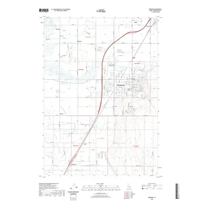
2020 Map of Rexburg
USGS Topo · Published 2020About this map
Rexburg serves as the regional hub of Madison County, shaped by its proximity to the South Teton River and an extensive network of irrigation canals that have sustained this agricultural valley for over a century. The city's landscape is anchored by the campus of Brigham Young University Idaho and the Madison County Courthouse, reflecting its dual role as a center for education and civic administration. The surrounding plains are marked by historic rural settlements such as Salem, Sugar City, and Thornton, which are interconnected by a grid of farm roads and industrial infrastructure like the S Railroad Ave.
Find a feature on this map
94 named features on this map. Tap any name to fly to it.
Don’t see what you’re looking for? This feature index may not catch every label — zoom into the map to look around manually.
Map Details
Editions of this 2020 Rexburg Map
This is the sole edition of this map. No revisions or reprints were ever made.
Other maps of this area

1948 · Rigby
USGS Topo · 1:24,000

1948 · Parker
USGS Topo · 1:24,000

1949 · Rexburg
USGS Topo · 1:24,000

1949 · Rigby
USGS Topo · 1:24,000

1950 · Ririe
USGS Topo · 1:24,000

1950 · Parker
USGS Topo · 1:24,000

1950 · Rexburg
USGS Topo · 1:24,000

1950 · St Anthony
USGS Topo · 1:24,000

1950 · Rigby
USGS Topo · 1:62,500

1951 · Moody
USGS Topo · 1:24,000