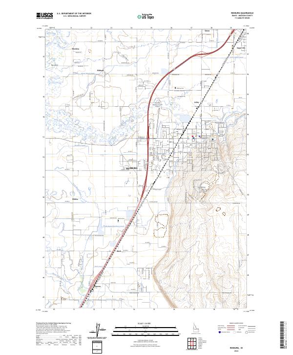
2024 Map of Rexburg
USGS Topo · Published 2024About this map
Rexburg serves as the hub of this Madison County landscape, dominated by the sprawling campus of Brigham Young University - Idaho and the Madison County Courthouse. The city's growth is framed by an intricate network of irrigation and water management, with the Rexburg Canal, Westfield Branch Canal, and City of Rexburg Ditch threading through the urban grid. To the north, Sugar City and Jolley sit near the Teton Island Canal, reflecting the region's agricultural roots.
Find a feature on this map
62 named features on this map. Tap any name to fly to it.
Don’t see what you’re looking for? This feature index may not catch every label — zoom into the map to look around manually.
Map Details
Editions of this 2024 Rexburg Map
This is the sole edition of this map. No revisions or reprints were ever made.
Other maps of this area

1948 · Rigby
USGS Topo · 1:24,000

1948 · Parker
USGS Topo · 1:24,000

1949 · Rexburg
USGS Topo · 1:24,000

1949 · Rigby
USGS Topo · 1:24,000

1950 · Ririe
USGS Topo · 1:24,000

1950 · Parker
USGS Topo · 1:24,000

1950 · Rexburg
USGS Topo · 1:24,000

1950 · St Anthony
USGS Topo · 1:24,000

1950 · Rigby
USGS Topo · 1:62,500

1951 · Moody
USGS Topo · 1:24,000