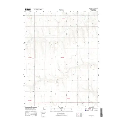
2015 Map of Rexford NE
USGS Topo · Published 2015About this map
The N Fork Solomon River meanders across the northern reaches of this Sheridan County landscape, cutting a winding path through the high plains. Further south, the drainage of S Bow Cr defines the lower third of the quadrangle, illustrating the subtle but essential water systems of the region. This survey, produced by the U.S. Geological Survey, reveals a highly organized agricultural grid defined by a network of section-line roads, including Co RD 380 and RD 100 N. The map provides a clear look at the township and range divisions, such as t7s r29w, which underpin the land ownership and development patterns in this part of Kansas. The absence of dense settlements emphasizes the rural, wide-open character of the territory during this period.
Find a feature on this map
18 named features on this map. Tap any name to fly to it.
Don’t see what you’re looking for? This feature index may not catch every label — zoom into the map to look around manually.
Map Details
Editions of this 2015 Rexford NE Map
This is the sole edition of this map. No revisions or reprints were ever made.
Other maps of this area

1951 · Selden
USGS Topo · 1:62,500

1954 · Goodland
USGS Topo · 1:250,000

1956 · Goodland
USGS Topo · 1:250,000

1957 · Goodland
USGS Topo · 1:250,000

1978 · Selden
USGS Topo · 1:24,000

1978 · Selden SW
USGS Topo · 1:24,000

1978 · Dresden South
USGS Topo · 1:24,000

1979 · Menlo
USGS Topo · 1:24,000

1979 · Rexford
USGS Topo · 1:24,000

1979 · Hoxie
USGS Topo · 1:24,000