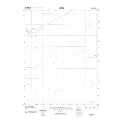
2009 Map of Rexford
USGS Topo · Published 2009About this map
Rexford serves as the primary residential anchor in this High Plains landscape, where the town grid is defined by streets like North St, South St, and School St. The surrounding Thomas County terrain is shaped by the subtle drainage of the North Fork Solomon River and South Bow Creek, which cut across the predominantly agricultural sections. Transportation and infrastructure are concentrated along the northern corridor, where Williams St connects the settlement to the broader regional road network. A notable localized landmark is the Stevenson Airport, situated to the east, reflecting the reliance on small-scale aviation in this rural part of the Kansas plains. The map illustrates a highly organized township-and-range layout, with county roads such as Co Rd W and Co Rd V following section lines that divide the open country between the watercourses.
Find a feature on this map
13 named features on this map. Tap any name to fly to it.
Don’t see what you’re looking for? This feature index may not catch every label — zoom into the map to look around manually.
Map Details
Editions of this 2009 Rexford Map
This is the sole edition of this map. No revisions or reprints were ever made.
Other maps of this area

1951 · Selden
USGS Topo · 1:62,500

1951 · Achilles
USGS Topo · 1:62,500

1954 · Goodland
USGS Topo · 1:250,000

1956 · Goodland
USGS Topo · 1:250,000

1957 · Goodland
USGS Topo · 1:250,000

1978 · Selden
USGS Topo · 1:24,000

1978 · Achilles SE
USGS Topo · 1:24,000

1978 · Selden SW
USGS Topo · 1:24,000

1979 · Menlo
USGS Topo · 1:24,000

1979 · Rexford
USGS Topo · 1:24,000