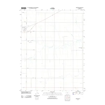
2012 Map of Rexford
USGS Topo · Published 2012About this map
Rexford serves as the primary hub for this section of Thomas County, situated at the intersection of a sprawling rural grid and the local rail line. The village layout is clearly defined by its central core along Main St, Center St, and Front St, with the local Po and school property situated just south of the main residential blocks. This 2012 survey highlights the persistence of small-town infrastructure in the High Plains, where the community remains anchored between the agricultural expanse and the winding course of the N Fork Solomon River to the south. Further into the countryside, the Rexford Cem and the Stevenson Private Airport appear as distinct landmarks amidst the section lines. The presence of S Bow Cr in the southern portion of the map indicates the drainage patterns that have historically influenced land use and settlement in this prairie landscape.
Find a feature on this map
26 named features on this map. Tap any name to fly to it.
Don’t see what you’re looking for? This feature index may not catch every label — zoom into the map to look around manually.
Map Details
Editions of this 2012 Rexford Map
This is the sole edition of this map. No revisions or reprints were ever made.
Other maps of this area

1951 · Selden
USGS Topo · 1:62,500

1951 · Achilles
USGS Topo · 1:62,500

1954 · Goodland
USGS Topo · 1:250,000

1956 · Goodland
USGS Topo · 1:250,000

1957 · Goodland
USGS Topo · 1:250,000

1978 · Selden
USGS Topo · 1:24,000

1978 · Achilles SE
USGS Topo · 1:24,000

1978 · Selden SW
USGS Topo · 1:24,000

1979 · Menlo
USGS Topo · 1:24,000

1979 · Rexford
USGS Topo · 1:24,000