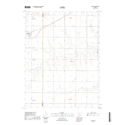
2018 Map of Rexford
USGS Topo · Published 2018About this map
Rexford sits at the intersection of a vast grid of section roads and highway routes, marking a classic High Plains settlement pattern on the border of Thomas and Sheridan counties. This 2018 survey shows a landscape dominated by agriculture and the watershed of the N Fork Solomon River, which meanders across the central portion of the quadrangle. Local history is anchored by the Rexford Cem located southwest of the town center, while the Stevenson Private Airport on the eastern edge reflects modern rural transport needs. The southern reaches of the map are defined by the headwaters of S Bow Cr, providing a stark contrast to the rigid geometry of the surrounding section lines like RD 100 N and RD 150 W.
Find a feature on this map
41 named features on this map. Tap any name to fly to it.
Don’t see what you’re looking for? This feature index may not catch every label — zoom into the map to look around manually.
Map Details
Editions of this 2018 Rexford Map
This is the sole edition of this map. No revisions or reprints were ever made.
Other maps of this area

1951 · Selden
USGS Topo · 1:62,500

1951 · Achilles
USGS Topo · 1:62,500

1954 · Goodland
USGS Topo · 1:250,000

1956 · Goodland
USGS Topo · 1:250,000

1957 · Goodland
USGS Topo · 1:250,000

1978 · Selden
USGS Topo · 1:24,000

1978 · Achilles SE
USGS Topo · 1:24,000

1978 · Selden SW
USGS Topo · 1:24,000

1979 · Menlo
USGS Topo · 1:24,000

1979 · Rexford
USGS Topo · 1:24,000