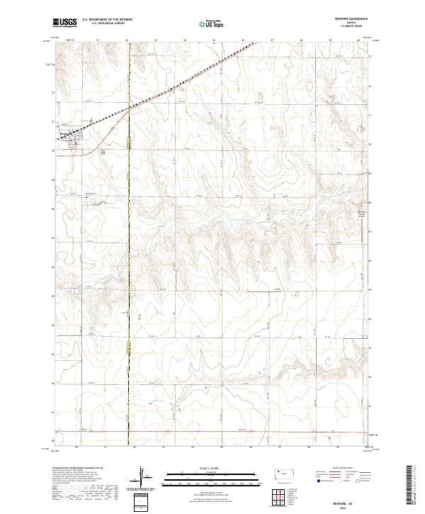
2022 Map of Rexford
USGS Topo · Published 2022About this map
Rexford serves as the primary hub of this High Plains landscape, situated at the intersection of a sprawling rural road network and the border of Thomas and Sheridan Counties. The settlement's grid, including Kansas Ave and North St, transitions quickly into the agricultural sections of t6s r31w and t7s r31w. To the south, the Rexford Cemetery marks a significant site for local genealogy, while the Stevenson Private Airport underscores the importance of aerial access in this expansive region.
Find a feature on this map
34 named features on this map. Tap any name to fly to it.
Don’t see what you’re looking for? This feature index may not catch every label — zoom into the map to look around manually.
Map Details
Editions of this 2022 Rexford Map
This is the sole edition of this map. No revisions or reprints were ever made.
Other maps of this area

1951 · Selden
USGS Topo · 1:62,500

1951 · Achilles
USGS Topo · 1:62,500

1954 · Goodland
USGS Topo · 1:250,000

1956 · Goodland
USGS Topo · 1:250,000

1957 · Goodland
USGS Topo · 1:250,000

1978 · Selden
USGS Topo · 1:24,000

1978 · Achilles SE
USGS Topo · 1:24,000

1978 · Selden SW
USGS Topo · 1:24,000

1979 · Menlo
USGS Topo · 1:24,000

1979 · Rexford
USGS Topo · 1:24,000