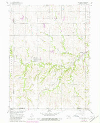
1960 Map of Reynolds
USGS Topo · Published 1980About this map
Reynolds serves as a central hub in this corner of Jefferson County, where the iron rails of the Burlington Northern meet the rural agricultural landscape. The town sits just north of the winding Rose Creek, which snakes through the southern half of the quadrangle before crossing into Kansas. To the east, the small settlement of Thompson marks a junction near the Chicago Rock Island and Pacific railroad line, illustrating the critical role of rail transport in the mid-century Nebraska economy.
Find a feature on this map
20 named features on this map. Tap any name to fly to it.
Don’t see what you’re looking for? This feature index may not catch every label — zoom into the map to look around manually.
Map Details
Editions of this 1960 Reynolds Map
2 editions found
Other maps of this area

1893 · Washington
USGS Topo · 1:125,000

1955 · Manhattan
USGS Topo · 1:250,000

1955 · Lincoln
USGS Topo · 1:250,000

1956 · Manhattan
USGS Topo · 1:250,000

1957 · Manhattan
USGS Topo · 1:250,000

1957 · Lincoln
USGS Topo · 1:250,000

1958 · Lincoln
USGS Topo · 1:250,000

1960 · Fairbury SW
USGS Topo · 1:24,000

1960 · Reynolds
USGS Topo · 1:24,000

1960 · Hubbell
USGS Topo · 1:24,000