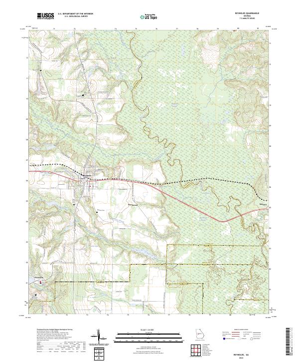
2024 Map of Reynolds
USGS Topo · Published 2024About this map
Reynolds serves as the focal point for this survey of Taylor County, Georgia, where the local street grid intersects the E Fall Line Freeway. The landscape is defined by the winding course of the Flint River, which forms natural boundaries amidst the lowlands of Magnolia Swamp and Beechwood Swamp. These wetlands, interspersed with tributaries like Patsiliga Creek and Beaver Creek, dictate the placement of local settlements and roads, creating a distinct pattern of upland habitation surrounded by dense riverine networks.
Find a feature on this map
82 named features on this map. Tap any name to fly to it.
Don’t see what you’re looking for? This feature index may not catch every label — zoom into the map to look around manually.
Map Details
Editions of this 2024 Reynolds Map
This is the sole edition of this map. No revisions or reprints were ever made.
Other maps of this area

1955 · Phenix City
USGS Topo · 1:250,000

1956 · Fort Valley
USGS Topo · 1:62,500

1957 · Phenix City
USGS Topo · 1:250,000

1957 · Macon
USGS Topo · 1:250,000

1958 · Macon
USGS Topo · 1:250,000

1958 · Phenix City
USGS Topo · 1:250,000

1964 · Macon
USGS Topo · 1:250,000

1971 · Fickling Mill
USGS Topo · 1:24,000

1971 · Reynolds
USGS Topo · 1:24,000
1971 · Roberta
USGS Topo · 1:24,000