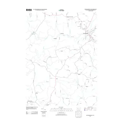
2013 Map of Reynoldsville
USGS Topo · Published 2013About this map
Reynoldsville serves as the primary hub of this Jefferson County landscape, where the confluence of Soldier Run and Sandy Lick Creek historically shaped the local orientation. The surrounding territory is characterized by a high density of small named settlements and junctions that speak to the area's development, including Wishaw, Eleanor, and the curiously named Panic. The map details a complex network of rural routes such as O'Donnell Road and Burning Gas Well Road, which weave through the drainage basins of Little Sandy Creek and Big Run. Notable landmarks like the Reynoldsville Fire Tower and the southern valley of Battle Hollow provide distinct geographic anchors. This survey documents the modern footprint of these communities, showing how smaller nodes like Deemers Crossroads and Meredith persist alongside the larger borough.
Find a feature on this map
126 named features on this map. Tap any name to fly to it.
Don’t see what you’re looking for? This feature index may not catch every label — zoom into the map to look around manually.
Map Details
Editions of this 2013 Reynoldsville Map
This is the sole edition of this map. No revisions or reprints were ever made.
Other maps of this area

1906 · Punxsutawney
USGS Topo · 1:62,500

1909 · Smicksburg
USGS Topo · 1:62,500

1922 · Du Bois
USGS Topo · 1:62,500

1924 · Du Bois
USGS Topo · 1:62,500

1924 · Brookville
USGS Topo · 1:62,500

1926 · Brookville
USGS Topo · 1:62,500

1938 · Smicksburg
USGS Topo · 1:62,500

1939 · Smicksburg
USGS Topo · 1:62,500

1939 · Punxsutawney
USGS Topo · 1:62,500

1942 · Punxsutawney
USGS Topo · 1:62,500
Featured Places
- Reynoldsville, PA
- McCalmont Township, PA
- Murray Summit, Winslow Township
- O'Donnell, Winslow Township
- Winslow Township, PA