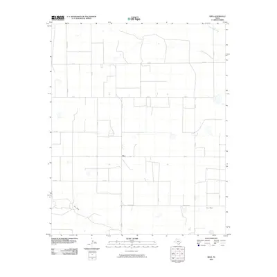
2010 Map of Rhea
USGS Topo · Published 2010About this map
Rhea sits at the heart of this High Plains landscape, where the geometry of the Texas Panhandle's section-line roads meets the natural curves of the drainage system. The settlement is positioned along Fm 2013, surrounded by an extensive network of county roads including Co Rd B and Co Rd F that facilitate the region's agricultural commerce. This 2010 survey highlights the contrast between the rigid human grid and the meandering path of Tierra Blanca Creek in the north and the wide basin of Frio Draw to the south. These ephemeral watercourses are critical landmarks in the Parmer County terrain, defining the subtle shifts in elevation across the plains. For researchers, the map provides a clear picture of rural land use and the specific intersection points of farm-to-market routes like Fm 1731 and Ranch Rd 2013.
Find a feature on this map
18 named features on this map. Tap any name to fly to it.
Don’t see what you’re looking for? This feature index may not catch every label — zoom into the map to look around manually.
Map Details
Editions of this 2010 Rhea Map
This is the sole edition of this map. No revisions or reprints were ever made.
Other maps of this area

1954 · Clovis
USGS Topo · 1:250,000

1957 · Pleasant Hill
USGS Topo · 1:62,500

1958 · Clovis
USGS Topo · 1:250,000

1965 · Bovina
USGS Topo · 1:24,000

1965 · Parmerton
USGS Topo · 1:24,000

1965 · Twin Lakes
USGS Topo · 1:24,000

1965 · Rhea
USGS Topo · 1:24,000

1971 · Bootleg
USGS Topo · 1:24,000

1971 · Garcia Lake
USGS Topo · 1:24,000

1971 · Bellview
USGS Topo · 1:24,000