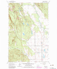
1962 Map of Rhodes
USGS Topo · Published 1983About this map
Stillwater River meanders through the eastern portion of this landscape, defining a wide valley between the timbered slopes of the Flathead National Forest and the Stillwater State Forest. This mid-century survey captures a rural Montana community organized around the central drainage of Lost Creek, where family-scale landmarks like the Bissell Sch and the Stillwater Ch serve as local hubs. The western terrain is dominated by prominent features like Pete Ridge and Pilot, descending sharply into Rhodes Draw near the small settlement of Rhodes. This area reflects a transition from the structured forestry and upland peaks to the wetland-rich lowlands where numerous small water bodies, including Cliff Lake and Hanson-Doyle Lake, are tucked into the glacial topography. The Northwest Flathead Community Hall stands as a focal point for the dispersed residents living along the secondary roads that connect these forest edges.
Find a feature on this map
26 named features on this map. Tap any name to fly to it.
Don’t see what you’re looking for? This feature index may not catch every label — zoom into the map to look around manually.
Map Details
Editions of this 1962 Rhodes Map
2 editions found
Other maps of this area

1943 · Kalispell
USGS Topo · 1:125,000

1957 · Kalispell
USGS Topo · 1:250,000

1960 · Kalispell
USGS Topo · 1:250,000

1961 · Kalispell
USGS Topo · 1:250,000

1962 · Rose Crossing
USGS Topo · 1:24,000

1962 · Blue Grass Ridge
USGS Topo · 1:24,000

1962 · Beaver Lake
USGS Topo · 1:24,000

1962 · Lost Creek Divide
USGS Topo · 1:24,000

1962 · Rhodes
USGS Topo · 1:24,000
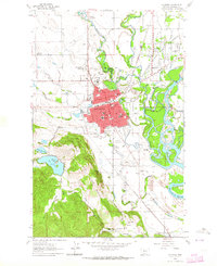
1962 · Kalispell
USGS Topo · 1:24,000