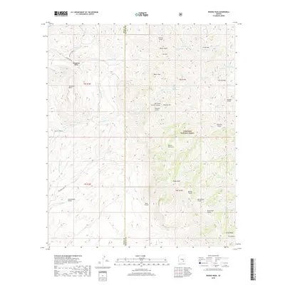
2018 Map of Rhodes Peak
USGS Topo · Published 2018About this map
Sombrero Butte and the surrounding high desert of the Galiuro Mountains anchor this 2018 study of the Pinal and Graham County line. The landscape is defined by its water sources and ranching access, evidenced by the network of named springs like Norton Spring, Whittling Spring, and Cake Mountain Spring. These points of reliable water supported the early routes through the canyonlands, including Bunker Hill Mine Rd and Tom Rhodes Ranch Rd. The survey details the high-altitude terrain within the Coronado National Forest, rising to prominent summits at Rhodes Peak and Maverick Mtn. Deep incisions like Pipestem Canyon and Ringtail Canyon drain toward the western flats, creating a complex topography of ridges such as Grassy Ridge. This modern record preserves the legacy of local land use, from isolated livestock tanks like Fourmile Tank to the namesake peaks of the Galiuro range.
Find a feature on this map
57 named features on this map. Tap any name to fly to it.
Don’t see what you’re looking for? This feature index may not catch every label — zoom into the map to look around manually.
Map Details
Editions of this 2018 Rhodes Peak Map
This is the sole edition of this map. No revisions or reprints were ever made.
Other maps of this area

1911 · Winkelman
USGS Topo · 1:125,000

1913 · Winkelman
USGS Topo · 1:125,000

1938 · Galiuro Mts
USGS Topo · 1:48,000

1938 · Klondyke
USGS Topo · 1:48,000

1943 · Galiuro Mts
USGS Topo · 1:62,500

1943 · Klondyke
USGS Topo · 1:62,500

1948 · Clark Ranch
USGS Topo · 1:24,000

1948 · Mammoth
USGS Topo · 1:62,500

1948 · Peppersauce Wash
USGS Topo · 1:24,000

1949 · Clark Ranch
USGS Topo · 1:24,000