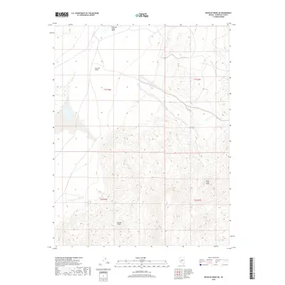
2018 Map of Rhyolite Ridge SW
USGS Topo · Published 2018About this map
Silver Peak Range peaks dominate the southeastern portion of this terrain, where the high desert landscape drops sharply toward the basin floor. This 2018 survey captures the transition from high mountain slopes into the alluvial fans of Fish Lake Valley, a remote arid basin. In the northern reaches, the Fish Lake Valley Marsh indicates a rare concentration of surface water and wetlands within this desert environment. Water remains a critical defining feature of the topography, as evidenced by isolated points like Deep Spring and Mud Spring found at different elevations. Between the mountain front and the valley floor, the deep incision of Icehouse Canyon provides a primary drainage path through the steep contours, illustrating the erosional forces that have shaped the Esmeralda County landscape.
Find a feature on this map
10 named features on this map. Tap any name to fly to it.
Don’t see what you’re looking for? This feature index may not catch every label — zoom into the map to look around manually.
Map Details
Editions of this 2018 Rhyolite Ridge SW Map
This is the sole edition of this map. No revisions or reprints were ever made.
Other maps of this area

1898 · Silver Peak
USGS Topo · 1:125,000

1900 · Silver Peak
USGS Topo · 1:125,000

1908 · Lida
USGS Topo · 1:250,000

1913 · Lida
USGS Topo · 1:250,000

1917 · White Mountain
USGS Topo · 1:125,000

1947 · Mariposa
USGS Topo · 1:250,000

1948 · Mariposa
USGS Topo · 1:250,000

1954 · Goldfield
USGS Topo · 1:250,000

1955 · Goldfield
USGS Topo · 1:250,000

1957 · Mariposa
USGS Topo · 1:250,000