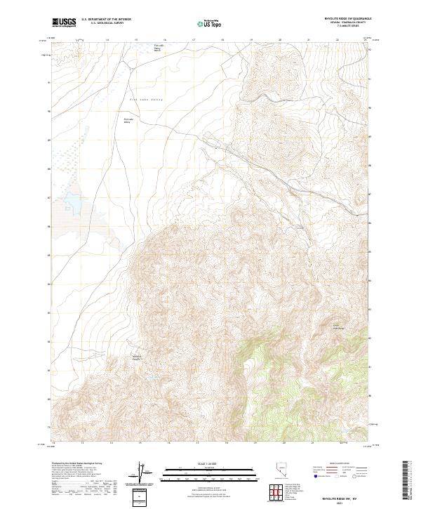
2021 Map of Rhyolite Ridge SW
USGS Topo · Published 2021About this map
Fish Lake Valley dominates this high-desert basin in Esmeralda County, where the dramatic elevation change between the valley floor and the towering Silver Peak Range is clearly defined. The hydrological contrast of the region is evident in the transition from the Fish Lake Valley Marsh in the north to the arid canyons and hidden water sources further south. Small, vital water points such as Deep Spring and Mud Spring are tucked within the complex topography, serving as critical landmarks in a landscape otherwise defined by sharp ridges and drainages like Icehouse Canyon. This survey provides an exact look at the natural boundaries and water resources of a remote Nevada wilderness before more recent environmental shifts might alter these subtle features.
Find a feature on this map
11 named features on this map. Tap any name to fly to it.
Don’t see what you’re looking for? This feature index may not catch every label — zoom into the map to look around manually.
Map Details
Editions of this 2021 Rhyolite Ridge SW Map
This is the sole edition of this map. No revisions or reprints were ever made.
Other maps of this area

1898 · Silver Peak
USGS Topo · 1:125,000

1900 · Silver Peak
USGS Topo · 1:125,000

1908 · Lida
USGS Topo · 1:250,000

1913 · Lida
USGS Topo · 1:250,000

1917 · White Mountain
USGS Topo · 1:125,000

1947 · Mariposa
USGS Topo · 1:250,000

1948 · Mariposa
USGS Topo · 1:250,000

1954 · Goldfield
USGS Topo · 1:250,000

1955 · Goldfield
USGS Topo · 1:250,000

1957 · Mariposa
USGS Topo · 1:250,000