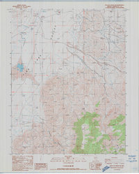
1987 Map of Rhyolite Ridge SW
USGS Topo · Published 1987About this map
Fish Lake Valley dominates the western portion of this 1980s landscape, a high-desert floor punctuated by isolated water sources and industrial remnants. The terrain transitions from the alluvial flats near Flowing Well and Mud Spring to the steep eastern ridges, where the influence of mining is evident through features such as Prospects, Tailings, and an Open Pit Mine. Small markers of human occupation and movement appear as a Ruin and the localized path through The Crossing. To the south, Icehouse Canyon carves into the upland slopes, providing a distinct drainage route amidst the arid elevations. This map captures a moment in the Great Basin’s late 20th-century history, documenting the continued interplay between sparse desert hydrology and the persistent search for mineral wealth in the mountains of Esmeralda County.
Find a feature on this map
66 named features on this map. Tap any name to fly to it.
Don’t see what you’re looking for? This feature index may not catch every label — zoom into the map to look around manually.
Map Details
Editions of this 1987 Rhyolite Ridge SW Map
This is the sole edition of this map. No revisions or reprints were ever made.
Other maps of this area

1898 · Silver Peak
USGS Topo · 1:125,000

1900 · Silver Peak
USGS Topo · 1:125,000

1908 · Lida
USGS Topo · 1:250,000

1913 · Lida
USGS Topo · 1:250,000

1917 · White Mountain
USGS Topo · 1:125,000

1947 · Mariposa
USGS Topo · 1:250,000

1948 · Mariposa
USGS Topo · 1:250,000

1954 · Goldfield
USGS Topo · 1:250,000

1955 · Goldfield
USGS Topo · 1:250,000

1957 · Mariposa
USGS Topo · 1:250,000