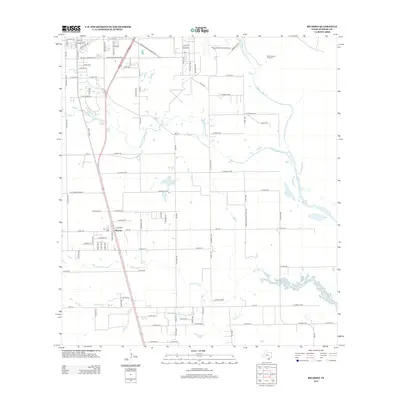
2013 Map of Ricardo
USGS Topo · Published 2013About this map
The settlement of Ricardo serves as the focal point of this South Texas landscape, situated along the corridor formed by Hwy 77 Bus and the Union Pacific rail lines. The area is characterized by a network of drainage creeks, including San Fernando Cr, Santa Gertrudis Cr, and Jaboncillos Cr, which wind through the coastal plains. These waterways define the rural tracts and the placement of local infrastructure, such as the Bordo Nuevo Windmill located to the northeast.
Find a feature on this map
101 named features on this map. Tap any name to fly to it.
Don’t see what you’re looking for? This feature index may not catch every label — zoom into the map to look around manually.
Map Details
Editions of this 2013 Ricardo Map
This is the sole edition of this map. No revisions or reprints were ever made.
Other maps of this area

1924 · Petronilla
USGS Topo · 1:62,500

1928 · Sarita
USGS Topo · 1:125,000

1950 · Corpus Christi
USGS Topo · 1:250,000

1952 · Riviera Beach
USGS Topo · 1:24,000

1952 · Riviera Beach NW
USGS Topo · 1:24,000

1952 · Riviera Beach
USGS Topo · 1:62,500

1954 · Kingsville
USGS Topo · 1:62,500

1954 · Petronila
USGS Topo · 1:62,500

1954 · Riviera
USGS Topo · 1:62,500

1956 · Corpus Christi
USGS Topo · 1:250,000