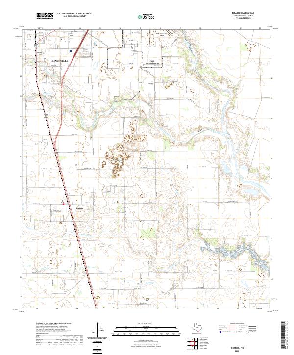
2022 Map of Ricardo
USGS Topo · Published 2022About this map
Kingsville and the nearby settlement of Ricardo anchor this landscape, where the coastal plains are deeply carved by a network of ephemeral waterways. The northern edge of the map is dominated by the extensive Kingsville Naval Air Station, a significant military presence that defines the regional geography alongside the southern reaches of the city. Water features like Dick Kleberg Park Lake and the meandering San Fernando Creek provide distinctive landmarks within the grid of county roads. The terrain is characterized by these creek systems, including Santa Gertrudis Creek and Jabonciilos Cr, which influence the local drainage and land use patterns. Genealogists and local historians will find the San Fernando Cemetery situated between these drainages, serving as a quiet record of the community's heritage in Kleberg County.
Find a feature on this map
88 named features on this map. Tap any name to fly to it.
Don’t see what you’re looking for? This feature index may not catch every label — zoom into the map to look around manually.
Map Details
Editions of this 2022 Ricardo Map
This is the sole edition of this map. No revisions or reprints were ever made.
Other maps of this area

1924 · Petronilla
USGS Topo · 1:62,500

1928 · Sarita
USGS Topo · 1:125,000

1950 · Corpus Christi
USGS Topo · 1:250,000

1952 · Riviera Beach
USGS Topo · 1:24,000

1952 · Riviera Beach NW
USGS Topo · 1:24,000

1952 · Riviera Beach
USGS Topo · 1:62,500

1954 · Kingsville
USGS Topo · 1:62,500

1954 · Petronila
USGS Topo · 1:62,500

1954 · Riviera
USGS Topo · 1:62,500

1956 · Corpus Christi
USGS Topo · 1:250,000