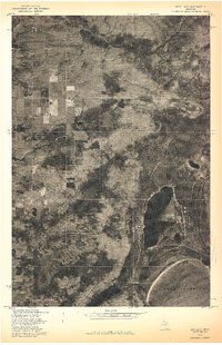
1978 Map of Rice Lake
USGS Topo · Published 1978About this map
Lake Superior defines the southern edge of this orthophotograph, where the coastline meets the wooded interior of Houghton County. This 1978 advance print combines aerial imagery from October with the land lines from a 1954 survey, providing a unique hybrid view of the Keweenaw Peninsula’s landscape. The dominant inland feature, Rice Lake, is surrounded by a complex network of wetlands and forested sections, visible through the varying textures of the October foliage. The orthophoto format reveals the specific patterns of land use and vegetation that traditional topographic maps often generalize, showing clearings and dense timber stands within the grid of Townships 55 and 56 North. This document serves as a specialized record of the shoreline and interior hydrology before later decades of environmental change.
Find a feature on this map
4 named features on this map. Tap any name to fly to it.
Don’t see what you’re looking for? This feature index may not catch every label — zoom into the map to look around manually.
Map Details
Editions of this 1978 Rice Lake Map
This is the sole edition of this map. No revisions or reprints were ever made.
Other maps of this area

1938 · Bruneau Creek
USGS Topo · 1:31,680

1938 · Gay
USGS Topo · 1:31,680

1941 · Ahmeek
USGS Topo · 1:31,680

1941 · Mohawk
USGS Topo · 1:31,680

1946 · Bruneau Creek
USGS Topo · 1:24,000

1946 · Mohawk
USGS Topo · 1:24,000

1946 · Ahmeek
USGS Topo · 1:24,000

1946 · Laurium
USGS Topo · 1:24,000

1947 · Ahmeek
USGS Topo · 1:24,000

1948 · Laurium
USGS Topo · 1:24,000