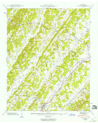
1943 Map of Riceville
USGS Topo · Published 1960About this map
Riceville and the Oostanaula Valley dominate this 1943 survey, which reveals a landscape defined by small-scale agriculture and early 20th-century transport networks. The Southern railroad and the Lee Highway run parallel through the valley, anchoring settlements like Coile and Georgetown. This corridor highlights the transition from localized milling, represented by Mouse Creek Mill, to broader regional connectivity. Away from the valley floor, the terrain is characterized by a series of prominent ridges, including Rogers Ridge and Spring Creek Ridge. The map is particularly rich in local community landmarks, such as Idlewild Sch, New Hopewell Ch, and Mt Lebanon Sch, which served the scattered farmsteads across the undulating hills of McMinn County. The distribution of family-named cemeteries like Horton Cem and Sullins Cem provides essential data for researchers tracing the early inhabitants of this part of East Tennessee.
Find a feature on this map
60 named features on this map. Tap any name to fly to it.
Don’t see what you’re looking for? This feature index may not catch every label — zoom into the map to look around manually.
Map Details
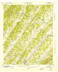
Editions of this 1943 Riceville Map
2 editions found
Other maps of this area

1886 · Cleveland
USGS Topo · 1:125,000

1887 · Kingston
USGS Topo · 1:125,000

1891 · Kingston
USGS Topo · 1:125,000

1892 · Cleveland
USGS Topo · 1:125,000

1893 · Kingston
USGS Topo · 1:125,000

1895 · Cleveland
USGS Topo · 1:125,000

1901 · Cleveland
USGS Topo · 1:125,000

1935 · Niota
USGS Topo · 1:24,000

1935 · Calhoun
USGS Topo · 1:24,000

1935 · Athens
USGS Topo · 1:24,000