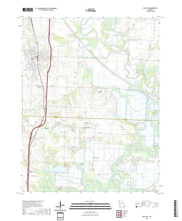
2021 Map of Rich Hill
USGS Topo · Published 2021About this map
Rich Hill stands as the primary hub of this Western Missouri landscape, characterized by a complex network of waterways and managed drainage. The northern reaches are defined by the winding Marais des Cygnes River and Bates County Drainage Ditch, creating a wetlands-rich environment that includes Bailey Lake and Bagley Lake. The southern portion of the map transitions toward the confluence area of the Little Osage River and Osage River, where prominent terrain features like Deer Mound and Baker Bend overlook the river valley.
Find a feature on this map
87 named features on this map. Tap any name to fly to it.
Don’t see what you’re looking for? This feature index may not catch every label — zoom into the map to look around manually.
Map Details
Editions of this 2021 Rich Hill Map
This is the sole edition of this map. No revisions or reprints were ever made.
Other maps of this area

1886 · Nevada
USGS Topo · 1:125,000

1887 · Butler
USGS Topo · 1:125,000

1894 · Butler
USGS Topo · 1:125,000

1894 · Nevada
USGS Topo · 1:125,000

1934 · Papinsville
USGS Topo · 1:24,000

1936 · Rich Hill
USGS Topo · 1:24,000

1937 · New Home
USGS Topo · 1:24,000

1938 · Metz
USGS Topo · 1:24,000

1938 · Horton
USGS Topo · 1:24,000

1939 · Metz
USGS Topo · 1:24,000