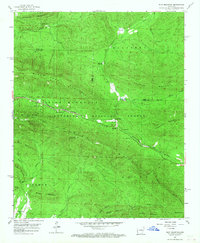
1958 Map of Rich Mountain
USGS Topo · Published 1967About this map
Rich Mountain and the towering ridgeline of Black Fork Mountain dominate this landscape on the Scott and Polk county line during the late 1950s. The Kansas City Southern railroad serves as the primary artery through this high country, threading through Eagle Gap and connecting the small settlements of Rich Mountain and Eagleton. These communities are situated within the Ouachita National Forest, where resource management is marked by the Eagle Gap Ranger Station and the Rich Mountain Lookout Tower.
Find a feature on this map
38 named features on this map. Tap any name to fly to it.
Don’t see what you’re looking for? This feature index may not catch every label — zoom into the map to look around manually.
Map Details
Editions of this 1958 Rich Mountain Map
3 editions found

Other maps of this area

1879 · Poteau Mountain
USGS Topo · 1:62,500

1887 · Poteau Mountain #1
USGS Topo · 1:62,500

1887 · Poteau Mountain #2
USGS Topo · 1:62,500

1890 · Poteau Mountain
USGS Topo · 1:125,000

1899 · Poteau Mountain
USGS Topo · 1:125,000

1939 · Waldron
USGS Topo · 1:62,500

1940 · Waldron
USGS Topo · 1:62,500

1941 · Waldron
USGS Topo · 1:62,500

1949 · Waldron
USGS Topo · 1:62,500

1950 · Mcalester
USGS Topo · 1:250,000