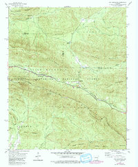
1958 Map of Rich Mountain
USGS Topo · Published 1979About this map
The Rich Mountain ridge line dominates the high country of the Ouachita National Forest during the late 1950s, serving as a corridor for both the Kansas City Southern railroad and the scenic Skyline Drive. This area, straddling the border of Polk and Scott counties, reveals the infrastructure of forest management and early tourism. The Rich Mountain Lookout Tower stands atop the peak, while Wilhelmina State Park provides a dedicated recreational area near the western edge of the quadrangle. In the valleys below, the settlement of Eagleton sits near the Eagle Gap Ranger Sta, reflecting a landscape defined by forestry and transportation.
Find a feature on this map
41 named features on this map. Tap any name to fly to it.
Don’t see what you’re looking for? This feature index may not catch every label — zoom into the map to look around manually.
Map Details
Editions of this 1958 Rich Mountain Map
3 editions found

Other maps of this area

1879 · Poteau Mountain
USGS Topo · 1:62,500

1887 · Poteau Mountain #1
USGS Topo · 1:62,500

1887 · Poteau Mountain #2
USGS Topo · 1:62,500

1890 · Poteau Mountain
USGS Topo · 1:125,000

1899 · Poteau Mountain
USGS Topo · 1:125,000

1939 · Waldron
USGS Topo · 1:62,500

1940 · Waldron
USGS Topo · 1:62,500

1941 · Waldron
USGS Topo · 1:62,500

1949 · Waldron
USGS Topo · 1:62,500

1950 · Mcalester
USGS Topo · 1:250,000