
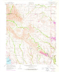
1956 Map of Richards Spur
USGS Topo · Published 1959About this map
Richards Spur sits at the base of dramatic rocky outcrops in this mid-1950s survey of the northern edge of Fort Sill. The landscape is a mix of agricultural lowlands and ridges, notably where the St Louis-San Francisco railroad cuts through the terrain near a Quarry and Porter Hill. This era captures the rural community structure of Comanche County, showing institutional anchors such as the Cache Creek Mission, Stony Point School, and the Paradise Valley Church. Water management and natural drainage define the western half of the map, including the northern reaches of Lake Lawtonka, which is accompanied by an Abandoned fish hatchery. Numerous creeks, including Chandler Creek and Ketch Creek, weave through the foothills, illustrating the complex hydrology of the region before further modern development altered these drainage patterns.
Find a feature on this map
22 named features on this map. Tap any name to fly to it.
Don’t see what you’re looking for? This feature index may not catch every label — zoom into the map to look around manually.
Map Details
Editions of this 1956 Richards Spur Map
2 editions found
Other maps of this area

1937 · Cache
USGS Topo · 1:48,000

1942 · Cache
USGS Topo · 1:62,500

1946 · Lawton
USGS Topo · 1:62,500

1949 · Mount Scott
USGS Topo · 1:24,000

1949 · Arbuckle Hill
USGS Topo · 1:24,000

1949 · Elgin
USGS Topo · 1:24,000

1949 · Fort Sill
USGS Topo · 1:24,000

1950 · Saddle Mountain
USGS Topo · 1:62,500

1955 · Lawton
USGS Topo · 1:250,000

1956 · Arbuckle Hill
USGS Topo · 1:24,000