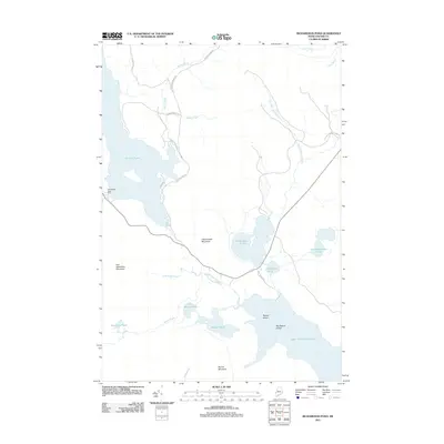
2011 Map of Richardson Pond
USGS Topo · Published 2011About this map
Upper Richardson Lake and the interconnected water bodies of Oxford County define this wilderness landscape, where timber and water management have long shaped the local geography. The Aziscohos Dam regulates the waters of Aziscohos Pond, while the sprawling Sunday Pond lies to the north, linked by a network of logging and service roads like Lincoln Pond Rd and Barney Brook Rd. The terrain is punctuated by prominent peaks including Observatory Mountain and Low Aziscohos Mountain, which overlook a complex system of smaller basins such as Pepperpot Pond and the East Richardson Ponds. This 2011 survey captures the area's essential character as a managed northern forest, showing the intricate drainage patterns of Deer Mountain Stream and Fish Pond Brook that feed into the larger lakes. The presence of Beaver Island and Big Beaver Island within the primary lake provides clear landmarks for navigating these significant Maine waters.
Find a feature on this map
29 named features on this map. Tap any name to fly to it.
Don’t see what you’re looking for? This feature index may not catch every label — zoom into the map to look around manually.
Map Details
Editions of this 2011 Richardson Pond Map
This is the sole edition of this map. No revisions or reprints were ever made.
Other maps of this area

1927 · Second Lake
USGS Topo · 1:62,500

1930 · Errol
USGS Topo · 1:62,500

1931 · Cupsuptic
USGS Topo · 1:48,000

1932 · Second Lake
USGS Topo · 1:62,500

1934 · Cupsuptic
USGS Topo · 1:62,500

1934 · Errol
USGS Topo · 1:62,500

1935 · Cupsuptic
USGS Topo · 1:62,500

1940 · Oquossoc
USGS Topo · 1:62,500

1942 · Oquossoc
USGS Topo · 1:62,500

1949 · Jackman
USGS Topo · 1:250,000
Featured Places
- Magalloway Plantation, ME
- Lincoln Plantation, ME
- Adamstown Township, ME
- Richardsontown Township, ME
- Parkertown Township, ME