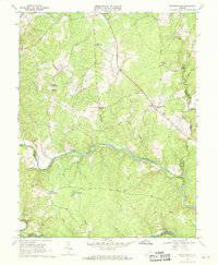
1968 Map of Richardsville
USGS Topo · Published 1970About this map
The Rappahannock River and Rapidan River converge at the southeastern edge of this terrain, marking a historic juncture of county boundaries between Culpeper, Fauquier, Stafford, Orange, and Spotsylvania. The landscape in the late 1960s was defined by small rural hubs like Richardsville, Goldvein, and Sumerduck, connected by a network of winding secondary roads and runs. Evidence of community life is frequent, from the Union Ch and Ebenezer Ch to the recreational grounds of Camp Happyland near the center of the sheet. The naming of Goldvein and Mine Run points toward the area's geological history, while the dispersed settlements of Silver Hill and Pine View reflect a traditional Piedmont agricultural pattern. Numerous small family or community cemeteries and isolated church sites like Clevers Oak Ch offer significant detail for genealogical research.
Find a feature on this map
30 named features on this map. Tap any name to fly to it.
Don’t see what you’re looking for? This feature index may not catch every label — zoom into the map to look around manually.
Map Details
Editions of this 1968 Richardsville Map
3 editions found
Other maps of this area

1887 · Spottsylvania
USGS Topo · 1:125,000

1892 · Spottsylvania
USGS Topo · 1:125,000

1894 · Warrenton
USGS Topo · 1:125,000

1894 · Warrenton
USGS Topo · 1:62,500

1927 · Remington
USGS Topo · 1:48,000

1930 · Warrenton
USGS Topo · 1:62,500

1943 · Catlett
USGS Topo · 1:62,500

1943 · Germanna Bridge
USGS Topo · 1:24,000

1943 · Chancellorsville
USGS Topo · 1:24,000

1943 · Salem Church
USGS Topo · 1:24,000