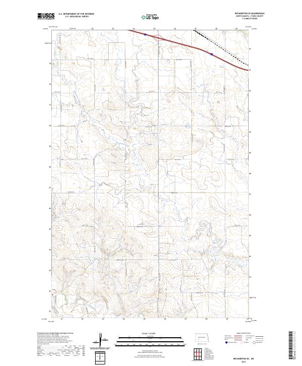
2024 Map of Richardton SE
USGS Topo · Published 2024About this map
Heart River winds through the southern reaches of this Stark County landscape, while the serpentine course of Government Creek carves a path through the central and eastern sections. This 2024 map documents a rural drainage basin defined by a strictly organized grid of range roads and section lines, including 91st Ave SW and 87th Ave SW. The survey area transitions from the higher plateaus in the north down toward the river valley in the south, illustrating the contemporary topography of the North Dakota plains. The absence of major settlements focuses attention on the natural watercourses and the established township boundaries like t139n r92w and t138n r93w, which continue to dictate the local land use and property divisions across this agricultural region.
Find a feature on this map
20 named features on this map. Tap any name to fly to it.
Don’t see what you’re looking for? This feature index may not catch every label — zoom into the map to look around manually.
Map Details
Editions of this 2024 Richardton SE Map
This is the sole edition of this map. No revisions or reprints were ever made.
Other maps of this area

1953 · Dickinson
USGS Topo · 1:250,000

1957 · Dickinson
USGS Topo · 1:250,000

1960 · White Butte NW
USGS Topo · 1:24,000

1960 · Clark Butte NW
USGS Topo · 1:24,000

1960 · White Butte NE
USGS Topo · 1:24,000

1973 · Bratburg Butte
USGS Topo · 1:24,000

1973 · Taylor
USGS Topo · 1:24,000

1973 · Richardton SE
USGS Topo · 1:24,000
1973 · Richardton
USGS Topo · 1:24,000
1973 · Antelope
USGS Topo · 1:24,000