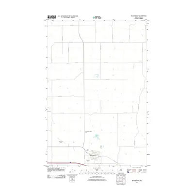
2011 Map of Richardton
USGS Topo · Published 2011About this map
Richardton serves as the central hub of this Stark County landscape, oriented around a grid of rural section-line roads and the regional infrastructure of the early 21st century. The town's spiritual and community history is anchored by the Assumption Abbey Dam and Abbey Lake, reflecting the influence of the nearby monastic tradition. Local heritage is further preserved at Saint Marys Cemetery and Evangelical Cemetery, providing essential data points for genealogists and family historians researching the settlement of this portion of North Dakota. Outside the immediate town site, the Richardton Airport and a network of arterial routes like County Rd 139 show the area's modern connectivity within a predominantly agricultural landscape, where the vast majority of the terrain is defined by the survey-grid roads such as 29th St SW and 89th Ave SW.
Find a feature on this map
24 named features on this map. Tap any name to fly to it.
Don’t see what you’re looking for? This feature index may not catch every label — zoom into the map to look around manually.
Map Details
Editions of this 2011 Richardton Map
This is the sole edition of this map. No revisions or reprints were ever made.
Other maps of this area

1953 · Dickinson
USGS Topo · 1:250,000

1953 · Watford City
USGS Topo · 1:250,000

1957 · Dickinson
USGS Topo · 1:250,000

1957 · Watford City
USGS Topo · 1:250,000

1967 · Watford City
USGS Topo · 1:250,000

1973 · Bratburg Butte
USGS Topo · 1:24,000

1973 · Marshall SE
USGS Topo · 1:24,000

1973 · Taylor
USGS Topo · 1:24,000

1973 · Willow Creek West
USGS Topo · 1:24,000

1973 · Marshall SW
USGS Topo · 1:24,000