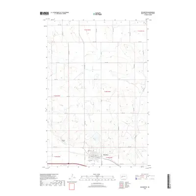
2018 Map of Richardton
USGS Topo · Published 2018About this map
The town of Richardton anchors the southern portion of this landscape, serving as a focal point for the surrounding agricultural grid. This area of Stark County is defined by its rectilinear road network, with routes like 37th St SW and 88th Ave SW dividing the terrain into standard sections. Local history is preserved in the presence of two distinct burial sites near the town center, Saint Marys Cem and Evangelical Cem, reflecting the community's early social and religious foundations. North of the primary settlement, the terrain is marked by Abbey Lake, a significant water feature in an otherwise high-plains environment. The Richardton Airport sits just west of the town, illustrating the area's modern infrastructure needs and its connection to the wider region. Beyond the town limits, names like Rebel Rd and Hwy 8 N provide specific markers for researchers tracing local travel routes and property lines within the established township and range system.
Find a feature on this map
33 named features on this map. Tap any name to fly to it.
Don’t see what you’re looking for? This feature index may not catch every label — zoom into the map to look around manually.
Map Details
Editions of this 2018 Richardton Map
This is the sole edition of this map. No revisions or reprints were ever made.
Other maps of this area

1953 · Dickinson
USGS Topo · 1:250,000

1953 · Watford City
USGS Topo · 1:250,000

1957 · Dickinson
USGS Topo · 1:250,000

1957 · Watford City
USGS Topo · 1:250,000

1967 · Watford City
USGS Topo · 1:250,000

1973 · Bratburg Butte
USGS Topo · 1:24,000

1973 · Marshall SE
USGS Topo · 1:24,000

1973 · Taylor
USGS Topo · 1:24,000

1973 · Willow Creek West
USGS Topo · 1:24,000

1973 · Marshall SW
USGS Topo · 1:24,000