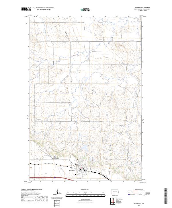
2024 Map of Richardton
USGS Topo · Published 2024About this map
Richardton serves as the primary hub of this Stark County landscape, defined by its religious and monastic foundations. The town is home to the Assumption Abbey Church, a significant landmark accompanied by the Assumption Abbey Cem and a nearby Crypt Grave. To the west, the Sacred Heart Monastery Cem sits adjacent to the Richardton Airport, illustrating the community's dual identity as a center of faith and local transport. The surrounding prairie is surveyed into a precise grid of rural roads, including Hwy 8 N and Rebel Rd, which connect scattered burial sites such as Saint Marys Cem and the Evangelical Lutheran Cem. This 2024 data reflects a deeply rooted rural settlement pattern where traditional institutions remain the most prominent physical markers of the territory.
Find a feature on this map
39 named features on this map. Tap any name to fly to it.
Don’t see what you’re looking for? This feature index may not catch every label — zoom into the map to look around manually.
Map Details
Editions of this 2024 Richardton Map
This is the sole edition of this map. No revisions or reprints were ever made.
Other maps of this area

1953 · Dickinson
USGS Topo · 1:250,000

1953 · Watford City
USGS Topo · 1:250,000

1957 · Dickinson
USGS Topo · 1:250,000

1957 · Watford City
USGS Topo · 1:250,000

1967 · Watford City
USGS Topo · 1:250,000

1973 · Bratburg Butte
USGS Topo · 1:24,000

1973 · Marshall SE
USGS Topo · 1:24,000

1973 · Taylor
USGS Topo · 1:24,000

1973 · Willow Creek West
USGS Topo · 1:24,000

1973 · Marshall SW
USGS Topo · 1:24,000