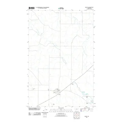
2011 Map of Richey
USGS Topo · Published 2011About this map
The town of Richey serves as a central hub in this northeastern Montana landscape, where human infrastructure meets the branching waterways of South Fork Lisk Creek and North Fork Lisk Creek. Local civic life is anchored by the Richey Post Office and Richey Vol Fire Dept, while the Richey Airport and the Richey Rest Area suggest the community's role as a waypoint for travelers and regional commerce.
Find a feature on this map
24 named features on this map. Tap any name to fly to it.
Don’t see what you’re looking for? This feature index may not catch every label — zoom into the map to look around manually.
Map Details
Editions of this 2011 Richey Map
This is the sole edition of this map. No revisions or reprints were ever made.
Other maps of this area

1909 · Glendive
USGS Topo · 1:250,000

1954 · Glendive
USGS Topo · 1:250,000

1957 · Glendive
USGS Topo · 1:250,000

1958 · Glendive
USGS Topo · 1:250,000

1972 · Clay Butte
USGS Topo · 1:24,000

1972 · Kuester Lake
USGS Topo · 1:24,000

1981 · Sidney
USGS Topo · 1:100,000
1983 · Duplisse Creek South
USGS Topo · 1:24,000
1983 · Richey
USGS Topo · 1:24,000

1983 · Circle Reservoir
USGS Topo · 1:24,000