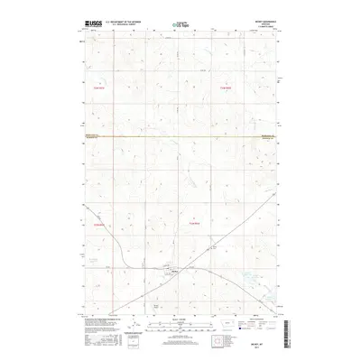
2017 Map of Richey
USGS Topo · Published 2017About this map
Richey serves as the focal point of this eastern Montana landscape, situated at the junction of Fas 254 and several county routes. The town’s layout is defined by Wheat Ave and Royal Ave, reflecting the agricultural character of the region. Just north of the main settlement lies the Richey Cem, a key site for genealogical research.
Find a feature on this map
26 named features on this map. Tap any name to fly to it.
Don’t see what you’re looking for? This feature index may not catch every label — zoom into the map to look around manually.
Map Details
Editions of this 2017 Richey Map
This is the sole edition of this map. No revisions or reprints were ever made.
Other maps of this area

1909 · Glendive
USGS Topo · 1:250,000

1954 · Glendive
USGS Topo · 1:250,000

1957 · Glendive
USGS Topo · 1:250,000

1958 · Glendive
USGS Topo · 1:250,000

1972 · Clay Butte
USGS Topo · 1:24,000

1972 · Kuester Lake
USGS Topo · 1:24,000

1981 · Sidney
USGS Topo · 1:100,000
1983 · Duplisse Creek South
USGS Topo · 1:24,000
1983 · Richey
USGS Topo · 1:24,000

1983 · Circle Reservoir
USGS Topo · 1:24,000