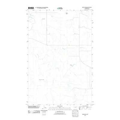
2011 Map of Richey NW
USGS Topo · Published 2011About this map
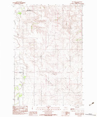
Redwater River flows through the northwest corner of this Montana landscape, anchoring a rural expanse defined by water management and a sparse road network. In this corner of Richland County, the drainage of Pasture Creek and the South Fork Lisk Creek reveals a pattern of agricultural modification. Numerous small reservoirs and dams, including Othar Number 1 Dam, Johnston Dam, and Lee Sa Number 2 Dam, illustrate the necessity of capturing runoff in this semi-arid environment. The presence of H S Dam further emphasizes how ranching or farming operations have shaped the natural waterways. This 2011 survey serves as a clear record of the local infrastructure, from the path of County Rd 301 to the alignment of Fas 254, providing a foundation for understanding the modern land use of the High Plains.
Find a feature on this map
10 named features on this map. Tap any name to fly to it.
Don’t see what you’re looking for? This feature index may not catch every label — zoom into the map to look around manually.
Map Details
Editions of this 2011 Richey NW Map
This is the sole edition of this map. No revisions or reprints were ever made.
Other maps of this area

1954 · Glendive
USGS Topo · 1:250,000

1957 · Glendive
USGS Topo · 1:250,000

1958 · Glendive
USGS Topo · 1:250,000
1983 · Duplisse Creek South
USGS Topo · 1:24,000
1983 · Richey
USGS Topo · 1:24,000

1983 · Buffalo Creek NE
USGS Topo · 1:24,000
1983 · Kraut Coulee
USGS Topo · 1:24,000

1983 · Circle Reservoir
USGS Topo · 1:24,000

1983 · Richey NW
USGS Topo · 1:24,000
1983 · Lisk Creek
USGS Topo · 1:24,000