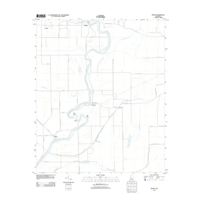
2012 Map of Richey
USGS Topo · Published 2012About this map
The Big Sunflower River defines the landscape of this Washington County region, its winding course punctuated by river crossings such as Murphy Ferry and Bommers Ferry. Small agricultural settlements including Richey, Bommers, and Murphy are scattered across a low-lying terrain etched with an intricate network of drainage ways like Big Widow Bayou and Straight Bayou. The map reveals the deep water-borne history of the Delta through features such as Hughey Point and the oxbow-like bends of Big Basin and Little Basin. An extensive grid of rural roads, including Pecan Grove Rd and Afro Domino Rd, connects these remote communities, reflecting a landscape dedicated to large-scale agriculture and water management in the early 21st century.
Find a feature on this map
60 named features on this map. Tap any name to fly to it.
Don’t see what you’re looking for? This feature index may not catch every label — zoom into the map to look around manually.
Map Details
Editions of this 2012 Richey Map
This is the sole edition of this map. No revisions or reprints were ever made.
Other maps of this area

1939 · Lorenzen
USGS Topo · 1:62,500

1939 · Swan Lake
USGS Topo · 1:62,500

1940 · Auter
USGS Topo · 1:62,500

1953 · Greenwood
USGS Topo · 1:250,000

1955 · Jackson
USGS Topo · 1:250,000

1956 · Greenwood
USGS Topo · 1:250,000

1961 · Jackson
USGS Topo · 1:250,000

1961 · Bayland
USGS Topo · 1:62,500

1962 · Jackson
USGS Topo · 1:250,000

1964 · Lorenzen
USGS Topo · 1:62,500