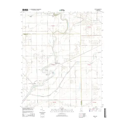
2015 Map of Richey
USGS Topo · Published 2015About this map
Richey and Murphy anchor this portion of the Mississippi Delta, a landscape defined by the intricate meandering of the Big Sunflower River and a dense network of bayous. The map captures the geography of Washington County, Humphreys County, and Sharkey County where they converge in a region of low-lying wetlands and agricultural tracts. Notable water features like Free Negro Bayou, De Viney Bayou, and Straight Bayou trace the old drainage patterns of the Delta, while names like Kongo, Bommers, and Auter mark localized centers of activity along the river's edge. The presence of Little Basin and Big Basin highlights the characteristic oxbow formations and hydrologic complexity of the river plain, illustrating the historical reliance on these waterways for both drainage and transportation.
Find a feature on this map
68 named features on this map. Tap any name to fly to it.
Don’t see what you’re looking for? This feature index may not catch every label — zoom into the map to look around manually.
Map Details
Editions of this 2015 Richey Map
This is the sole edition of this map. No revisions or reprints were ever made.
Other maps of this area

1939 · Lorenzen
USGS Topo · 1:62,500

1939 · Swan Lake
USGS Topo · 1:62,500

1940 · Auter
USGS Topo · 1:62,500

1953 · Greenwood
USGS Topo · 1:250,000

1955 · Jackson
USGS Topo · 1:250,000

1956 · Greenwood
USGS Topo · 1:250,000

1961 · Jackson
USGS Topo · 1:250,000

1961 · Bayland
USGS Topo · 1:62,500

1962 · Jackson
USGS Topo · 1:250,000

1964 · Lorenzen
USGS Topo · 1:62,500