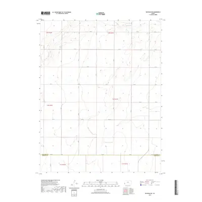
2018 Map of Richfield NE
USGS Topo · Published 2018About this map
Sand Arroyo Cr meanders across the high plains of Southwest Kansas in this late-2010s survey, marking a distinct drainage pattern through the agricultural landscape. The map illustrates the rigid Public Land Survey System grid that defines the region, where a network of section-line roads like S Rd Q, S Rd P, and S Rd N provide access to the vast tracts of farmland. The southern portion of the sheet is bisected by the Stanton Co Morton Co line, which follows the path of Dd Blvd. This intersection of natural watercourses and precise human geometry reflects the ongoing legacy of the Homestead Act and the development of the High Plains aquifer region. Local road designations such as RD 23 115 and Co RD 11 offer specific identifiers for genealogists and local historians tracing land ownership and transport routes between the townships of t29s r41w and t30s r41w.
Find a feature on this map
30 named features on this map. Tap any name to fly to it.
Don’t see what you’re looking for? This feature index may not catch every label — zoom into the map to look around manually.
Map Details
Editions of this 2018 Richfield NE Map
This is the sole edition of this map. No revisions or reprints were ever made.
Other maps of this area

1900 · Syracuse
USGS Topo · 1:125,000

1920 · Syracuse
USGS Topo · 1:125,000

1955 · Dodge City
USGS Topo · 1:250,000

1958 · Dodge City
USGS Topo · 1:250,000

1959 · Dodge City
USGS Topo · 1:250,000

1959 · Big Bow SW
USGS Topo · 1:24,000

1973 · Richfield NW
USGS Topo · 1:24,000

1973 · Shore Airport SW
USGS Topo · 1:24,000

1973 · Shore Airport
USGS Topo · 1:24,000
1973 · Manter
USGS Topo · 1:24,000