
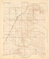
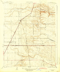
1929 Map of Richgrove
USGS Topo · Published 1929About this map
Richgrove and Vestal serve as primary anchors along the Southern Pacific rail line during this mid-1920s survey. The landscape is defined by the sharp transition between the irrigated valley floor and the rising foothills to the east, where seasonal waterways like the White River and Rag Gulch emerge. Agricultural development is evident through the named Quinn Ranch and the presence of the Thermal Sch, indicating a growing rural community centered around the Orange Belt Highway.
Find a feature on this map
13 named features on this map. Tap any name to fly to it.
Don’t see what you’re looking for? This feature index may not catch every label — zoom into the map to look around manually.
Map Details
Editions of this 1929 Richgrove Map
3 editions found
Other maps of this area

1926 · Quincy School
USGS Topo · 1:31,680

1927 · McFarland
USGS Topo · 1:31,680

1929 · Delano
USGS Topo · 1:31,680

1929 · Sausalito School
USGS Topo · 1:31,680

1929 · Quincy School
USGS Topo · 1:31,680

1929 · Ducor
USGS Topo · 1:31,680

1930 · McFarland
USGS Topo · 1:31,680

1931 · Deepwell Ranch
USGS Topo · 1:31,680

1932 · Woody
USGS Topo · 1:62,500

1935 · Woody
USGS Topo · 1:62,500