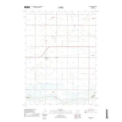
2017 Map of Richland
USGS Topo · Published 2017About this map
Richland serves as the central hub of this agricultural landscape in Colfax County, situated just north of the Platte River. The settlement pattern follows a rigid section-line grid, typical of the Nebraska plains, though the natural hydrology of the area introduces significant complexity. The broad Platte River valley is home to substantial landforms like Hewitt Island and Tomek Island, while managed drainage features such as Barnholdt Ditch and Shonka Ditch indicate the long-standing efforts to reclaim and utilize the fertile bottomlands.
Find a feature on this map
51 named features on this map. Tap any name to fly to it.
Don’t see what you’re looking for? This feature index may not catch every label — zoom into the map to look around manually.
Map Details
Editions of this 2017 Richland Map
This is the sole edition of this map. No revisions or reprints were ever made.
Other maps of this area

1899 · David City
USGS Topo · 1:125,000

1955 · Fremont
USGS Topo · 1:250,000

1957 · Fremont
USGS Topo · 1:250,000

1958 · Fremont
USGS Topo · 1:250,000

1958 · Columbus SE
USGS Topo · 1:24,000

1958 · Columbus
USGS Topo · 1:24,000

1966 · Clarkson SW
USGS Topo · 1:24,000

1966 · Humphrey SE
USGS Topo · 1:24,000
1966 · Clarkson SE
USGS Topo · 1:24,000
1968 · David City West
USGS Topo · 1:24,000