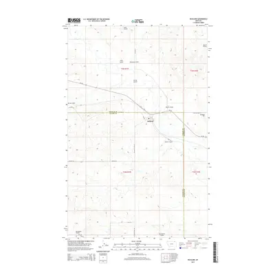
2014 Map of Richland
USGS Topo · Published 2014About this map
Richland serves as the primary focal point of this northeastern Montana landscape, situated along the border of Valley and Daniels Counties. The settlement is defined by a grid including 3rd Ave and is anchored by the Po, reflecting its role as a local center for the surrounding agricultural and ranching community. The topography is marked by a complex network of erosional drainage channels known as coulees, which dominate the terrain east and west of the townsite. Significant watercourses including Swift Coulee, Brockway Coulee, and Spring Coulee carve through the high plains, illustrating the drainage patterns that have shaped land use and ranch boundaries in this region for generations. To the east, the elevation rises toward Richland Hill, while a network of rural roads like Richland-Frazer Rd and Zemliska Rd connect isolated farmsteads across the vast township divisions.
Find a feature on this map
25 named features on this map. Tap any name to fly to it.
Don’t see what you’re looking for? This feature index may not catch every label — zoom into the map to look around manually.
Map Details
Editions of this 2014 Richland Map
This is the sole edition of this map. No revisions or reprints were ever made.
Other maps of this area

1954 · Wolf Point
USGS Topo · 1:250,000

1954 · Glasgow
USGS Topo · 1:250,000

1957 · Glasgow
USGS Topo · 1:250,000

1958 · Wolf Point
USGS Topo · 1:250,000

1958 · Glasgow
USGS Topo · 1:250,000

1973 · Larslan NW
USGS Topo · 1:24,000

1973 · Horseshoe Basin
USGS Topo · 1:24,000

1973 · Brockway Spring
USGS Topo · 1:24,000

1973 · Flaherty Coulee
USGS Topo · 1:24,000

1973 · Johnnys Hill
USGS Topo · 1:24,000